 The Tradition-Rich
Southern Port Village of
Chora Sfakion
by Minoa.info / Juhani
Updated 06.12.2012
Among
South Cretan villages Chora Sfakion is another stopping off point for
the coastal vessel route and the main village of the Sfakia area. The
Libyan Sea beyond the village and the African continent beyond the
horizon create their own unique atmosphere in the village. In the
village harbor there is the southernmost webcam in Europe.
Panoramic photo from the village.
The
village is away from mass tourism and also aside from busy routes
excluding coasting vessels. Not only the Cretan south western coast
route, but also the route to the Gavdos island starts from here
(another, to the island, starts from Paleochora).
Chora Sfakion
lies in the shadow of the White Mountains
When climbing up to the
Sfakia highland, the White Mountain range is seen in all its grandness.
Pachnes is the highest peak of the mountains, 2453 meters, and it is the
second highest peak on Crete. Stone pines, olive trees and tamarisks
give green color to this severe, but beautiful area.

Hikers from
the gorges arrive by boat to Chora Sfakion where the buses are waiting
for them
Measured by the amount of passing tourists, the village should
be big, but in reality it lives a peaceful life at the starting point
of the serpentine road that leads to the Sfakia highland and to the
Aradena gorge.
Sfakia has always been known for its independence
and it is probably the wildest area in Crete
The Sfakia area was the
centre of the resistance against the Turks and the Venetians. Rough
terrain and lack of roads saved it from major destruction during war
times. Sfakians, especially the older people, use a dialect that even
the Greeks find hard to understand.
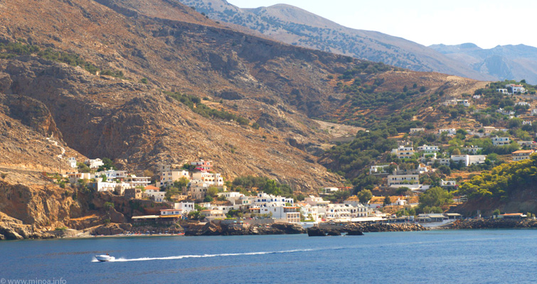
Two pictures below show the
character of the road that goes up to Sfakia and Aradena, and give a
good overall view of the village and its location.

The rebuilt, paved road from Chora Sfakion to Anopoli

The nature of
the area is wild
Many gorges from the coast, like Imbros,
Aradena and Samaria, and many trails, give excellent possibilities for
hiking. The routes of the trails often follow the old tracks used by the
donkeys. The requirements on the routes are more demanding than average
so the equipment must be in good condition. In July and August hiking
might be uncomfortable because of the high temperature, and it is
recommended only for experienced hikers.

In Chora Sfakion there
are a few good taverns at the quayside and some small hotels. From the
village it is possible, besides hiking, to take a boat and go to the
coastal villages. Cruising is interesting and fun because timetables can
be used to make a schedule that may include some time in a village,
eating and swimming. From the boat there are nice views to gorges like
Samaria, Eligia and Aradena as well to some smaller gorges.
Depending on
the day of the week the boat leaves from Chora Sfakion four or five
times a day. Tickets can be bought from the ticket office near the ship, charging only a few euros per ticket.
Almost
all taverns are at the seashore, and when dark, are pleasantly lit.
There is fish available from the Libyan Sea and also different kinds of
Sfakian foods.
BOOK A HOTEL (11 km to the east from Chora Sfakion, in Francocastello area). Bus routes to southwest villages. Chora Sfakion can be found by name “Sfakia”. Up-to-date schedules for boats. Chora Sfakion on Google maps.
Webcam in the harbor.
Webcam to the west (near the tavern “Three Brothers”).
Remember to share your stories and thoughts about Chora Sfakion in the comments.

