 The Gorge of Aradena
by Minoa.info / Juhani
Updated 23.03.2014
You can use two different routes to reach the Aradena Gorge. You can either rent a taxi boat from Chora Sfakion and walk through the gorge upward from the shore, or you can drive up to the gorge and walk it downward. The road to the gorge is steep and has no safety rails, but it has been paved with asphalt. It is a very manageable drive, but can not be recommended for those who suffer from a fear of heights. The steel bridge spanning over the gorge is one of the highest in Europe, but you can reach the gorge without crossing it as trails lead down from both sides of the gorge, from the northern side of the bridge.
In the picture you can see the serpentine road rising uphill from Chora Sfakionis to Aradena. There are no safety railings, as there is no suitable ground to fasten them. Looking up from Chora Sfakion the sloping hill seems endless, but when you reach the top you realize that the White Mountains extend a good way higher.
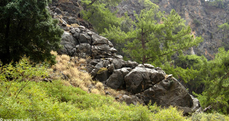
There is surprisingly thick forest cover up in Aradena. Aradena remained isolated, a wild world of its own, for a long time practising its own rules and traditions safe from conquerors. Rocky ground and rocky forests are typical, and there are a lot of abandoned buildings and villages in the area.
There are a lot of trailways in the area and old ruined villages are close to the roads, making it easy to visit them. There is a lot of beauty in the ruins colored with signs of time.
…
…
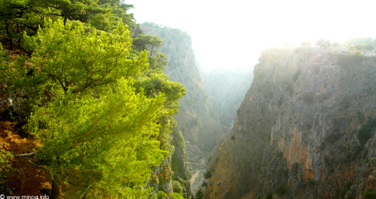
The Aradena gorge seen from the bridge to the south.
…
…
…
…
For trekkers the Aradena highlands is a world of its own. The view both to the Libyan Sea and to the snow-covered White Mountains is breathtaking. You can see snow up on the mountains as late as in early June. By the road there are a couple of taverns in Anapoli village and a kiosk on the other side of the bridge crossing the gorge.
…
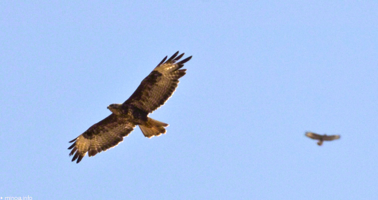
You can see a lot of predatory birds around Aradena. Both of the birds in the picture are Buzzards (Buteo buteo). The Buzzard is the most common day time predatory bird in Crete. Some fair colored Long-legged Buzzards (Buteo rufinus) with longer wings, legs and tail can also be seen in Crete(1)
The bridge crossing the gorge is made of steel, and the clattering sound from crossing vehicles can be heard miles away. You can see down to the bottom of the gorge through the planks which cover the bridge.
…
The Aradena bridge is 138 meters high and one of the highest in Europe.
The bridge is used for Bungee-jumping and the platform can be seen in the picture above.
The bridge is used for Bungee-jumping and the platform can be seen in the picture above.
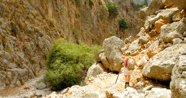
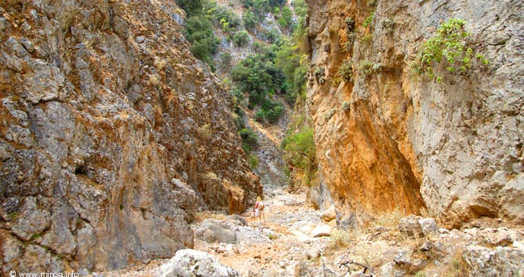
You can descend to the Aradena Gorge from several locations. On the bottom of the gorge a stony trail descends down to the sea and you can reach the sea easily following the main trail on the bottom of the gorge. In some places you have to look closely for the best way down and even slide on the stony surface to reach the lower level.
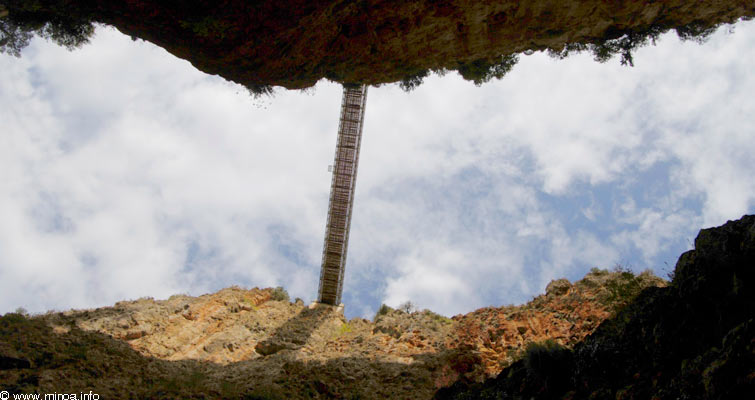
A large pile of fallen rocks can be passed with stony stairway rising high along the side of the gorge (photo below).
…

You can also try to go through the fallen rocks, but experience from climbing and demanding trekking is necessary. The ladders in the picture give some idea about the challenges of this route. (Photo above is taken to the north direction).
You can also try to go through the fallen rocks, but experience from climbing and demanding trekking is necessary. The ladders in the picture give some idea about the challenges of this route. (Photo above is taken to the north direction).
…
It takes about 2 to 3.5 hours to pass the gorge depending on speed and endurance. There is no fresh water in the gorge. The beautiful, many-sided gorge is medium level in difficulty and is not suitable for anyone suffering from fear of heights or vertigo.
It takes about 2 to 3.5 hours to pass the gorge depending on speed and endurance. There is no fresh water in the gorge. The beautiful, many-sided gorge is medium level in difficulty and is not suitable for anyone suffering from fear of heights or vertigo.
After hiking in the gorge for a couple of hours it is common to mistakenly hear the wind blowing in the gorge as the roar of the sea.
…
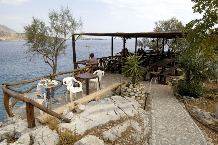
The gorge widens remarkably as you reach the shore where there is a tavern with accommodation at the waterfront.
The gorge widens remarkably as you reach the shore where there is a tavern with accommodation at the waterfront.
After passing the gorge down to the shore you have four options:
1. Hiking the gorge back up to the bridge.
2. Ordering a taxi boat to Chora Sfakion (take into account the waiting time).
3. Hiking up the mountains slope to the bridge via Liviana Village,
4. A hike along the waterfront trail to Loutro and a boat to Chora Sfakion.
…
…

Bigger photo
Route (3) back to bridge (see photo above) is a demanding 9 km serpentine gravel trail along the hot slope with no shade available. The view downward to the sea and the historical village of Foinikis is beautiful and some rare Jipaeto vultures can also be seen. This route demands good physical condition and endurance.
In the beginning the trail is a narrow trail passing through a rocky slope, but the rest of the way is a wider gravel road, and even asphalt as you get close to road to Aradena. The easiest option is to take a taxi up to the bridge, hike down through the gorge to the tavern, and have some lunch while waiting for the taxi boat to Chora Sfakion.
Additional Information:
Coordinates for the Aradena Bridge: 35°13’20.33”N 24° 3’43.05”E
Bus routes to southwest villages. Nearest bigger village of Aradena, Chora Sfakion can be found by name “Sfakia”
Bus routes to southwest villages. Nearest bigger village of Aradena, Chora Sfakion can be found by name “Sfakia”
Sources:
(1) Info from Bird expert Juha Rantaharju

